Alpena area saw normal weather patterns in March

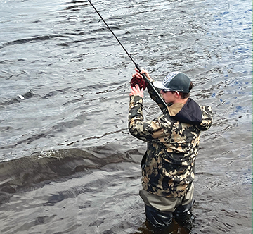
News Photo by Steve Schulwitz Marc Kirchner fishes in the Thunder Bay River despite the cool temperatures in Alpena Friday. Cold air, rain, and some snow are expected to remain in the area for several weeks.
ALPENA — It may have seemed like the temperatures and snow last month were not on par with what March weather typically offers, but the initial report from the National Weather Service shows most weather categories were near the historical long-term average.
Current forecasts predict the weather will continue to be more like winter than spring — at least for the next 10 days or so.
The NWS released its summary of the weather in March and it shows that there was little difference between the average snow amount and average temperatures that March usually provides.
The average temperature was 29.2 degrees, which is only marginally lower than the 29.3 degree average historically for March.
The high temperature for the month was 65 degrees on March 17 and the lowest point the mercury dipped to was minus-3 degrees in the early morning hours of March 3.
The largest dumping of snow at one time last month was on March 7, when Alpena received 3.8 of its 10.4 inches of snow for the month.
The average snowfall for March is 10.6 inches.
The brunt of the precipitation the area saw last month was in the form of rain. For the 31-day period, there was a total of 4.56 inches of precipitation that fell, well above the 1.8 inch historical average. The largest measured rainfall was on March 23 when 1.19 inches fell, most of it being rain.
National Weather Service Meteorologist Dan Cornish said the topsy-turvy weather pattern last month wasn’t unusual. He said large and sudden changes in weather like the area witnessed in March are common when one season transitions into another.
“It really is typical to see swings in the weather in transition months like those going from summer to fall or winter to spring,” Cornish said. “We see strong systems move through and we’ll have warm weather on the front side of them, and then cold behind it. That is what we saw most of last month.”
The weather outlook looking ahead the next several weeks doesn’t paint a sunny picture, Cornish said. He said periods of cold, rain, and snow still dot the forecast calendar, but he added there will be some days in the mid-40s sprinkled in.
As for when the area can see consistent warm weather, Cornish said it could be some time.
“It looks like the start of the month will bring colder than normal temperatures, but heading into the second half of April we might begin to see some warmer days,” he said. “Right now, it is hard to see when we will get the consistent warm up we are all looking for.”


