Heat expected to roll in next week
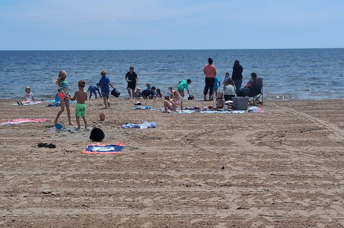
News photo by Josh Jambor Beachgoers of all ages enjoy Starlite Beach in Alpena on Friday afternoon. With heat index values forecast to climb into the mid-to upper 90s – and possibly the 100s next week NWS Meteorologist Sean Christensen is urging caution for vulnerable residents and pet owners.
ALPENA – Heat index values are forecasted to climb sharply across northern Michigan early next week, potentially reaching the mid- to upper 90s and even the 100s in some localized spots, according to National Weather Service Meteorologist Sean Christensen.
“Most of the region will see readings rise from the upper 70s and low 80s into much higher territory, with Tuesday, Wednesday, and potentially Thursday shaping up as the hottest days,” Christensen said.
Forecasters are keeping an eye on the development of convective showers and thunderstorms that often accompany hot, humid air. Those storms could moderate actual air temperatures somewhat while conditions still feel quite warm, Christensen said.
The heat index combines air temperatures with relative humidity to reflect how hot it actually feels. Hotter air holds more water vapor, which is why high heat index days often feel significantly more oppressive than the thermometer reading alone.
“When we see temperatures like this it is potentially hazardous, especially to those people in the area that are more vulnerable like the elderly and smaller children,” Christensen said.
The warning carries extra weight in Alpena and surrounding communities now that summer tourism season has arrived. Many residents and visitors spend time outdoors, whether for work, recreation or tourism activities along Lake Huron. Families and caregivers are urged to pay close attention to elderly relatives and neighbors as the heat builds.
Christensen offered some advice to pet owners regarding the danger of leaving your pet unattended in your vehicle in severe heat or outdoors in the sun.
“The inside of your car can bake like an oven, and it can get much warmer than outside temperatures indicate,” Christensen explained. “Do not leave them in your car unattended.”
The warmer pattern is expected to persist into the Independence Day holiday weekend. An early look shows relatively warm conditions continuing.
“Right now, it looks like it will be relatively warm. Tuesday through Thursday will probably be the warmest days of the week but it should remain relatively warm through the Fourth of July,” Christensen said.
The potential for pop-up storms adds another layer. While they may bring some relief from the highest temperatures, they can also introduce lightning, heavy rain and other hazards common with summertime convection.
Christensen encouraged residents to stay informed through National Weather Service updates and any official alerts. Conditions can evolve quickly as humidity levels and storm chances shift.
With the Fourth of July approaching, many local events and gatherings could coincide with the warmer stretch. Consider preparing now, whether that’s stocking extra water, adjusting schedules or making sure more vulnerable family members and pets have cool spaces.
Local News

Commissioners look ahead to fairgrounds’ future

Heat expected to roll in next week

Alcona County Library events
Prentiss Street closure
ALPENA - On Monday, Prentiss Street, between Harbor Drive and the pier will be closed to all traffic. Prentiss ...
Brush up on Great Lakes beach safety