
Mild stretch ahead for Alpena, with weekend highs in the 70s
Trending
ALPENA - Northeast Michigan is heading into a milder-than-normal stretch, with weekend highs in the 70s and no significant rain in the forecast, a National Weather Service meteorologist said Tuesday.
Patrick Bak, a meteorologist at the weather service office in Gaylord, said temperatures over the next week or so should run near or above normal. The normal high average temperature in the Alpena area this time of year is around 60 degrees.
"Right now, we do not have any significant precipitation events coming," Bak said. "For the next several days temperatures will be near or above normal."
The short-range forecast matches that outlook. Today looks to be mostly sunny, with a high near 67. A chance of showers returns Wednesday night into Thursday, but amounts are not expected to be heavy. Thursday's high is forecast around 59, closer to normal, before they climb again.
"This weekend looks pretty warm with highs in the 70s," Bak said.
The weather service forecast calls for a mostly sunny Saturday with a high near 69, then a mostly sunny Sunday with a high near 74. Columbus Day, Monday, is expected to be partly sunny with a high near 67. Overnight lows through the weekend are forecast to stay well above freezing along the shore, in the upper 40s to upper 50s.
The mild pattern does not mean every corner of Northeast Michigan will stay that warm. Bak said Friday morning lows are expected to fall into the 30s, but that probably will not produce a hard freeze in the Alpena area.
"However, there is a big difference between the areas near the coast and the areas inland," he said.
A hard freeze is generally considered a temperature of 28 degrees or lower, cold enough to end the growing season for many plants. Bak said some areas have probably already recorded their first hard freeze this fall. Places farther from Lake Huron are more exposed on clear, calm nights, when heat radiates away from the ground and cold air settles into low spots.
The lake is the main reason the shoreline stays milder.
"The lakes are still relatively warm so that helps the coastal areas," Bak said. "The water temperature around Alpena is still close to 60 degrees."
That relatively warm water keeps nighttime temperatures higher near the bay and along the Lake Huron shore than they are a few miles inland. The same gap can show up in the first frost of the season. Gardens and low-lying fields west of town can freeze while lawns closer to the water do not. Bak said that split is likely to matter again Friday morning, when inland spots have a better chance of dropping into the 30s than the city itself.
Early October has already run mild at Alpena. Preliminary climate data from the weather service show highs of 67, 64, 61 and 66 degrees on the first four days of the month, with lows ranging from 36 on Oct. 3 to 54 on Oct. 1. Measurable rain totaled 0.28 of an inch through Oct. 4, slightly below normal for that stretch.
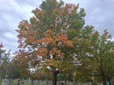
The dry, mild setup is arriving as fall color builds across northern Lower Michigan. Bak said foliage is outside his main area of expertise, but the calendar is not.
"We are getting closer to peak fall colors, which usually arrives the second or third week of October," he said.
Peak color in the northern Lower Peninsula often falls in that window, with shoreline forests lagging inland hardwoods by several days because lake-moderated air stays warmer. Cool nights above freezing, paired with sunny days, are generally the weather pattern that lets reds, oranges and yellows develop before a hard freeze or a windy rain strips the leaves. A hard freeze can damage leaf tissue and dull the display. A prolonged mild spell can slow the loss of green chlorophyll, especially near the lakes.
Nothing in the next several days points to that kind of abrupt end around Alpena.
The main thing to watch, Bak said, is the temperature gap between the coast and inland areas, not a regionwide freeze.
Residents farther from the lake may still see patchy frost in the usual cold spots Friday morning. Along the shore, the combination of 60-degree water and a milder-than-normal air mass should keep the first widespread hard freeze at bay for now.