April weather enters much like March exited, with precipitation

ALPENA – March had well above the historic long-term average for precipitation levels and the wet trend is expected to continue over the next couple days, National Weather Service Meteorologist Nicole Sprinkles said on Wednesday.
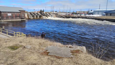
In March, Alpena received nearly 3 inches of precipitation above average. The moisture came in the form of snow, ice, and rain.
The forecast for today and Saturday appears as if the Alpena area could receive a significant amount of rain and possibly some freezing drizzle. The NWS is forecasting Alpena could receive as much as an inch or more of precipitation before Easter Sunday. Thunderstorms are also possible.
“On Thursday, we will be dealing with a mess that will move through the area, spreading from the south to the north all throughout the day into tonight,” Sprinkles said. “With that our temperatures are going to start out cooler and we are going to have a warmup that develops.”
How warm it gets as the day progresses will play a contributing factor in what form of precipitation we see in the Alpena area.
“Our main concern is what kind of precipitation type we might be getting from this; it looks like the biggest threat for freezing rain will be during the morning and afternoon hours,” Sprinkles said. “Temperatures are going to warm up throughout the day, as the day progresses everything will transition to mostly rain.”
As local temperatures transition from cold to warm, it also increases the likelihood of thunderstorms in Northeast Michigan, Sprinkles said.
“With those warmer temperatures this evening into tonight, there will be a chance for strong to severe thunderstorms,” Sprinkles explained. “With that there is a potential for gusty winds, and some hail that could form with that system as well.”
Temperatures are expected to continue to rise throughout Thursday and any ice the area may receive will likely be short-lived.
“Through the day the high will be around 36 degrees, temperatures will continue to rise throughout the night,” Sprinkles said. “Once we get to around midnight it could get up to the low 50’s tomorrow morning.”
Any ice accumulation is not expected to reach the depths we experienced when the ice storm moved through the area, Sprinkles said.
“We are leaning more towards a tenth of an inch of ice, with maybe some locally higher measurements closer to a quarter of an inch in the Alpena area,” she added.
As the area moves through the weekend, there is a chance for additional precipitation, however, with higher temperatures forecasted it’s likely to be mostly rain.
“It looks like we might have some rain showers move through Friday night into Saturday,” Sprinkles said. “With those warmer temperatures any precipitation will come in the form of rain.”
Speaking of warmer temperatures, as we look back on the month of March, it was slightly above normal for average temperature, with a high of nearly 70 degrees, and a low in the negatives.
“For the Alpena area the average temperature was 29.8 degrees which is about half a degree above what we would normally see,” Sprinkles said. “The warmest temperature was recorded on March 9 at 69 degrees, the coldest temperature we recorded was on March 2, and that was -6 degrees.”
Still, the amount of precipitation the area received in March easily blew past the long-term averages.
“For the Alpena area the overall precipitation was about 4.59 inches which was about 2.78 inches above normal. For observed snowfall we are looking at about 14 inches, which is about 3.4 inches above normal.”
“The snowiest day was March 13, and that was recorded at 5.6 inches,” Sprinkles added.
Local News

Rx Kids launches in Montmorency County, enrollment open

Lots happening in for Presque Isle District Library

Alpena DDA seeking donations for downtown flower fund
Pizzapalooza event for Relay for Life
ALPENA — On April 16 from 6 p.m. until 8 p.m. take a night off from cooking to Support the Relay for Life of ...
April weather enters much like March exited, with precipitation
