Snow, freezing rain, ice possible Sunday
Prepare now for possible ice storm and power outages

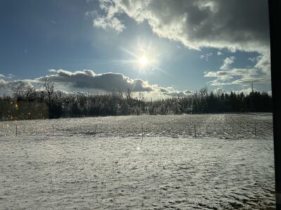
Photo by Emily Roussin A coat of ice covers from some shrubs in Alpena on Thursday. More ice could be on the way on Sunday, as the area may be in the path of a possible ice storm. Emily Roussin submitted the photo to The News on Thursday.
ALPENA – The forecast as we move into next week looks like a repeat of the last few days in Northeast Michigan. With another weather system moving in, Harold Dippman, meteorologist for the National Weather Service in Gaylord said the Alpena area is in store for foul weather.
As Friday’s system moves out of the area, another storm system will move into the region for Sunday and Monday.
Meteorologists have struggled to pinpoint where the heaviest snowfall and ice accumulation will occur. Some areas in Northeast Michigan could receive more than a foot of snow, while others may experience icing, which could exceed a half of an inch and cause power outtakes and topple trees.
“Over in the Alpena area, there will be a first round of snow that moves into the area, that will probably last through mid-day Sunday,” Dippman said. “That will bring some accumulations and then once the system really starts getting wound up that will change over to a wintry mix of sleet and freezing rain.”
As the system moves out of the area Sunday night into Monday morning the precipitation is expected to be mostly snow.
“This system will end as a shot of snow throughout the day on Monday,” Dippman said.
With last year’s ice storm still fresh in people’s memory, one major concern is ice accumulation. During that storm the Alpena area received between a half inch and an inch of ice, depending on your location.
“There is potential for some significant icing, at this point in time it looks like the swath of area that is going to be affected is a little bit narrower than last year’s ice storm in March,” Dippman explained. “It should be a bit more confined and concentrated as opposed to such a broad area like last year.”
It is yet to be determined if Alpena will be located in the heart of the ice storm’s path or ow much snow could fall locally.
“In terms of where this is going to set up, much remains to be seen. We are still getting a lot of data on the upcoming storm,” he said. ” It does look like there is potential for that to move into the Alpena area, but that is going to come with changes to the forecast in the coming days,” Dippman added.
Because of the size of the storm system, it has been difficult for meteorologists to predict exactly how much the Alpena area will receive.
“Unfortunately, we are dealing with a bigger system that is going to be prone to have changes to the forecast,” Dippman said. “There is potential for an increased amount of ice accumulation in any given area across northern lower Michigan, it’s just a matter of where it sets up.”
There is a possibility of power outages and limited travel, any preparations you have to make to deal with those situations should be implemented.
“It’s paramount to be ready for anything, there is potential for power outages with this system as it passes though, there is also potential for travel to be snarled. Whatever preparations you have to contend with those particular issues, I recommend beginning the initial stages of those plans.”
Despite the wintry mix of weather that is expected throughout the next few days, there is the potential for a slight warm up mid-week next week.
“We are going to go on a bit of a warming trend after these weather systems leave the area, Wednesday will probably be in the thirties, and Thursday we could hit 40 degrees,” Dippman said.
Local News

Alpena law enforcement officers trained on forensic interviews of children
Alpena County public safety committee meets
ALPENA — The Alpena County Courts and Public Safety Committee will meet on Monday at 4 p.m. in the Howard Male ...

Pulmonary, sleep and respiratory services moving at MyMichigan Alpena
APS to host job fair
ALPENA — Alpena Public Schools will hold a job fair for instructional assistants, and bus drivers on March 20 ...

Supporting the area’s youth