Forecast calls for wintry mix
Additional ice accumulation unlikely
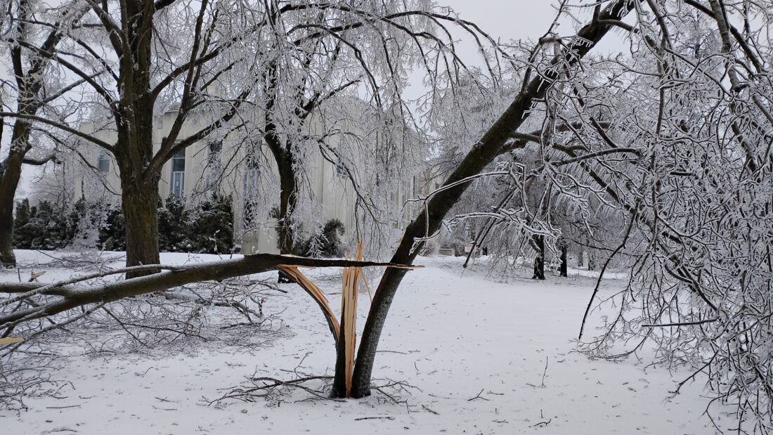
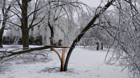
News photo by Josh Jambor A tree in front of the Alpena County Courthouse is split in two as a result of the recent ice storm.
ALPENA – With many residents still without power, the weather forecast is still a concern. Currently, the National Weather Service (NWS) forecast for the Alpena area calls for a mixture of snow and rain today, as well as Saturday night and into Sunday morning.
According to NWS Meteorologist Matt Gillen, the weather system that will move through the area today will most likely produce some rain accumulation with the possibility of a mixture of snowflakes.
“I think most of the snow from that weather system will impact the Upper Peninsula,” Gillen said. “I predict mostly rain for the Alpena area; this system will not be a big rain or snow maker.”
By this afternoon, as the weather front passes, the temperatures will rise and some of this accumulation in the area should begin to melt.
“Temperatures tomorrow, once the wintry mix passes through the area, should rise to above 40 degrees in the afternoon,” Gillen said.
Because the temperatures will be above freezing the risk of additional ice accumulation is highly unlikely.
“Temperatures should be above freezing if it rains, I don’t anticipate there will be any more ice accumulation for the Alpena area,” Gillen said. “Depending on how warm we get tomorrow, hopefully, most, if not all the ice, will melt off the trees and power lines.”
Gillen added that the weather system that will move into the area from Saturday night into Sunday morning is like the one that will pass through today.
“That late weekend into Sunday weather system, that one has a little more moisture with it with the potential for some mixed wintry weather again,” Gillen explained. “Including a low potential for freezing rain, but it’s not something to sound the alarm over in terms of ice accumulation, it should move through the area fairly quickly.”
“Temperatures will be marginal near freezing, so I do not anticipate a lot of issues with that system at this time,” Gillen added.
For the new work week, the NWS forecast calls for below average temperatures for this time of the year in the Alpena area.
“Temperatures will fall behind that weather system that moves through on Sunday, it’s unlikely Monday’s high temperature will be above 30 degrees,” Gillen said. “Then we go back into the teens Monday night.”
Next week, temperatures should start to rise again towards the middle of the week and into the weekend.
“As we go through the middle to later portions of next week it looks the temperatures will moderate again, maybe not true spring weather, but we should be above freezing most days next week,” Gillen said.
Alpena County Administrator Jesse Osmer told The News that Alpena County officials are watching the weather system.
“The weather is definitely something we are keeping a close eye on,” Osmer said. “We monitor the potential for any inclement weather daily as clean up and power restoration continues.”
Josh Jambor can be reached at jjambor@thealpenanews.com.
Local News

City of Alpena tells residents to wait for cleanup
Consumers Energy prioritizes restoration and community support in Northern Michigan
MICHIGAN — In a press release on Thursday, Consumers Energy announced its continued focus on restoration efforts ...

Alcona Schools Superintendent responds to impact of 2026 ice storm
Forecast calls for wintry mix

Sixteen Candles
