Exploring the depths
Inside the hunt for new shipwrecks, discoveries on Lake Huron’s floors

Stephanie Gandulla, acting research coordinator with the Thunder Bay National Marine Sanctuary, cast the lines off of the Research Vessel Storm at the Rogers City marina before heading out on the research vessel to map the bottom of Lake Huron.
ROGERS CITY — A team of researchers have been eager to learn what lies at the bottom of Lake Huron in some of the northernmost waters within the Thunder Bay National Marine Sanctuary’s boundaries.
Over the course of the past two weeks, researchers from around the U.S. have used an autonomous surface vessel named BEN, which stands for Bathymetric Explorer and Navigator, to map the bottom of Lake Huron just off the shores of Rogers City. No shipwrecks had been found in the expedition as of Wednesday, press time for this story, said Stephanie Gandulla, acting research coordinator for the sanctuary.
“We have definitely covered a lot of ground in the survey, so we’re out there mapping lake bottom,” she said. “We have found what we think are interesting geological formations, but no promising shipwreck targets, yet.”
Gandulla said the geological formations look similar to sinkholes, but that geologists will have to review the data before they can be certain. She said what’s cool about having that data is that, once it’s processed, it will be available in the public domain.
“Anyone can then look at the data with their expertise and maybe identify some things like sinkholes,” she said, adding the area is known for sinkholes because of the amount of limestone in the area.

A group of researchers from the University of New Hampshire’s Center for Coastal and Ocean mapping listen to Val Schmidt, ASV group lead and research engineer, in the group’s mobile laboratory in Rogers City. Pictured in the back row, from left to right, is KG Fairbarn, ASV scientist and engineer, and Andy McLeod, project engineer. Pictured in the front row, from left to right, is Roland Arsenault, software engineer, Val Schmidt, ASV group lead and research engineer, and Coral Moreno, a student at the university who is obtaining her doctorate degree.
The research team is comprised of scientists, engineers and programmers from the National Oceanic and Atmospheric Administration, the Ocean Exploration Trust, and the University of New Hampshire’s Center for Coastal and Ocean Mapping, whose scientists program and operate BEN.
The autonomous surface vessel played a key role in mapping the lake bottom. The 4-meter-long vessel comes equipped with a multi-beam sonar, which uses sound waves to create a picture of the lake bottom.
A “ping,” or sound wave, is sent out using sonar and scientists are able to determine the shape of the lake bottom by the amount of time it takes for that “ping” to bounce back. Scientists are also able to determine the texture of the lake bottom from the intensity of the return.
BEN has the ability to send out multiple sound waves at one time, which allows it to cover more territory.
It takes a couple people to operate the autonomous surface vessel. However, more engineers are present for the current expedition because of the research they’re doing on autonomous systems.

Photo Courtesy of Alpena Community College The ASV BEN, or autonomous surface vessel Bathymetric Explorer and Navigator, and the National Oceanic and Atmospheric Administration’s Research Vessel Storm leave the Rogers City marina during a research expedition to find shipwrecks and map the bottom of Lake Huron.
BEN is towed to the research location by NOAA’s Research Vessel Storm, which is operating as a support vessel for the autonomous vessel. Researchers on the Storm are also using their multi-beam sonar to scan the lake bottom.
Once both vessels arrive at the location, they start “mowing the lawn,” industry slang for the back-and-forth, overlapping patterns made over the designated search area.
Lindsay Gee, with the Ocean Exploration Trust, said one of the reasons researchers use autonomous surface vessels is that it can sometimes be dangerous when people are out in boats.
“So, with an autonomous system, you can take the person out of the boat, you can send them where you wouldn’t send people,” he said.
Gee said autonomous vessels could be used in instances where there is rough weather or could go to locations with dangerous conditions, such as Fukashima, Japan.

Photo Courtesy of Alpena Community College The National Oceanic and Atmospheric Administration’s Research Vessel Storm tows the ASV BEN, or autonomous surface vessel Bathymetric Explorer and Navigator, out to a location near the Rogers City shoreline, where both vessels will map the bottom of Lake Huron using multi-beam sonar.
A mobile laboratory was set up near the marina’s break wall in Rogers City, from which the team from the University of New Hampshire operated BEN. Inside the mobile lab, a number of monitors line the wall, each screen keeping track of something different.
One monitor allows researchers a view from the lake via cameras mounted on BEn, while a separate screen tracks marine traffic in the area. Another monitor keeps an eye on the weather forecast, which is updated frequently throughout the day.
The monitor the scientists are most interested in, however, is the one showing the real-time data that’s being collected by the autonomous surface vehicle from miles away.
A sticky note, located on one of the monitors, reminds the team to lower the transducer for the sonar. If the transducer isn’t lowered, it will pick up the bubbles from BEN’s wake, which will interfere with the sonar’s ability to create a clear picture.
Software engineer Roland Arsenault is responsible for programming the highly sophisticated software needed to run the autonomous vessel, which is done with many, many clicks of a mouse.
But Gee said the expedition is not just about mapping the lake bottom. The research team is also developing the technology required to make the autonomous vehicle truly autonomous. He says automation is evolving right now.
“People have very high expectations of autonomy. I think it will be a big part of the future of what we do,” he said. “There’s a lot that still has to be done, and that’s what these guys are doing, whether it’s software or artificial intelligence.”
Val Schmidt, research engineer and ASV group lead, said the expedition is working to achieve a couple of different goals at the same time. He said the primary goal is to find shipwrecks. However, they are also collecting data for the National Centers for Coastal Ocean Science.
He said that group will use the data to see what kind of habitat exists at the lake bottom and determine the health of fisheries in those surveyed areas. The data will also go to NOAA’s Office of Coast Survey, which will use it to update navigational charts.
The expedition focused on three unexplored areas of the marine sanctuary that — according to nautiluslive.com, oceanographer Bob Ballard’s exploration website — “embody the diverse and rich maritime cultural landscapes of the Great Lakes.”
Those areas include Spectacle Reef, Hammond Bay, and a portion of Shipwreck Alley, near the shipping lanes.
One of the shipwrecks researchers are hoping to find is the Ironton, a schooner that collided with the wooden freighter Ohio on Sept. 26, 1894, in rough weather. NOAA researchers discovered the Ohio in 2017, but the Ironton has yet to be found.
Gandulla said officials from the marine sanctuary notify the state of any shipwrecks they find on the lake bed, since the “bottom land” of the lake belongs to the state.
“The sanctuary works very closely with the state to identify and interpret any shipwrecks that we find for the public,” she said.
Crystal Nelson can be reached at cnelson@thealpenanews.com or 989-358-5687.
-

- Stephanie Gandulla, acting research coordinator with the Thunder Bay National Marine Sanctuary, cast the lines off of the Research Vessel Storm at the Rogers City marina before heading out on the research vessel to map the bottom of Lake Huron.
-

- A group of researchers from the University of New Hampshire’s Center for Coastal and Ocean mapping listen to Val Schmidt, ASV group lead and research engineer, in the group’s mobile laboratory in Rogers City. Pictured in the back row, from left to right, is KG Fairbarn, ASV scientist and engineer, and Andy McLeod, project engineer. Pictured in the front row, from left to right, is Roland Arsenault, software engineer, Val Schmidt, ASV group lead and research engineer, and Coral Moreno, a student at the university who is obtaining her doctorate degree.
-

- Photo Courtesy of Alpena Community College The ASV BEN, or autonomous surface vessel Bathymetric Explorer and Navigator, and the National Oceanic and Atmospheric Administration’s Research Vessel Storm leave the Rogers City marina during a research expedition to find shipwrecks and map the bottom of Lake Huron.
-

- Photo Courtesy of Alpena Community College The National Oceanic and Atmospheric Administration’s Research Vessel Storm tows the ASV BEN, or autonomous surface vessel Bathymetric Explorer and Navigator, out to a location near the Rogers City shoreline, where both vessels will map the bottom of Lake Huron using multi-beam sonar.
Lifestyles

The importance of community theaters in rural areas
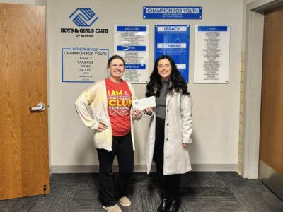
Supporting the area’s youth
Hello sun

Fun at the library in Harrisville
Historical artifacts, monuments, and memorials – a path through time: Celebrating the 50th Anniversary of the Alpena Bi-Path
